Camino de Santiago map: routes, distances, free maps
See where the seven Camino routes run and how long they are, where to get free official maps and GPS tracks, and when you need a map on the way.
The Camino is a network of routes that all end in Santiago de Compostela. Of the seven routes covered on this site, the Camino Francés is the best known. It runs about 770 kilometres from Saint-Jean-Pied-de-Port in France across northern Spain. The others come up from Portugal, along the north coast, from Oviedo, from Ferrol and from Seville, and one continues from Santiago out to the Atlantic.
Free official maps and GPS tracks are available from Spain’s National Geographic Institute (IGN) and from the Xunta de Galicia. On the route itself, yellow arrows and scallop shells show the way, so a paper map is rarely needed. A map is most useful where the route splits, in winter and on the less walked routes.
Where the routes run
| Route | Start | Length | Stages |
|---|---|---|---|
| Camino Francés | Saint-Jean-Pied-de-Port, France | about 770 km | 33 |
| Camino Portugués | Lisbon or Porto, Portugal | about 610 km from Lisbon | 25 from Lisbon |
| Camino del Norte | Irún, Spain | about 830 km | 36 |
| Camino Primitivo | Oviedo, Spain | about 320 km | 14 |
| Camino Inglés | Ferrol, Spain | about 115 km | 5 |
| Vía de la Plata | Seville, Spain | about 980 km | 37 |
| Camino Finisterre | Santiago de Compostela, Spain | about 90 km | 4 |
Six of the routes end in Santiago de Compostela. The Camino Finisterre starts there and heads west to Cape Finisterre. The figures are the same rounded figures as on the route pages. The sources measure slightly differently, and each route page lists them with figure and link.
On a map of Spain the routes lie like this:
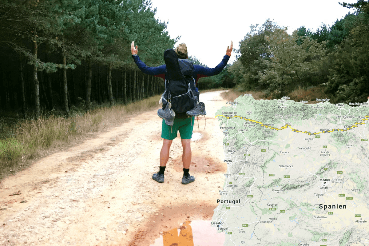
- The Camino Francés crosses the Pyrenees and runs through Pamplona, Burgos and León into Galicia.
- The Camino del Norte follows the north coast through the Basque Country, Cantabria and Asturias before it turns inland.
- The Camino Primitivo runs from Oviedo through the mountains and meets the Camino Francés at Melide.
- The Camino Portugués heads north from Lisbon and Porto. From Porto you can choose the central route or the coastal route.
- The Vía de la Plata runs from Seville through Mérida, Cáceres, Salamanca and Zamora.
- The Camino Inglés runs from the port town of Ferrol inland to Santiago.
If you are choosing between them, read the guide to which Camino route suits you. The overview of the whole pilgrim way is on the page about the Camino de Santiago.
The Camino Francés on the map
In 2010 the IGN published a map of the Camino Francés at a scale of 1:50,000. It consists of ten sheets with profiles of the stages and a 1:12,500 town plan of Santiago de Compostela.
The last section through Galicia begins at O Cebreiro. From there it is 155 kilometres to Santiago through San Xil and 162.2 kilometres through Samos, according to the Xunta de Galicia. The two variants part at Triacastela and meet again at Sarria.
The stages and their lengths are in the article on how long the Camino is. The towns you can begin in are covered in the guide to where to start the Camino Francés.
Official and free maps
IGN and CNIG. Spain’s National Geographic Institute (IGN) and its National Centre for Geographic Information (CNIG) run an online map, Caminos de Santiago en Europa, built with the Spanish federation of Camino associations. It shows the routes across Europe, both overland and the historic sea routes. When the IGN presented the map in 2018, it held 286 routes with more than 2,000 stages and 80,843 kilometres in 28 countries.
Xunta de Galicia. The Galician government has a page for each of the official routes at caminodesantiago.gal. Each page has a map of the route, a PDF guide and a KML file of the track. The pages cover the routes from the point where they enter Galicia.
The Pilgrim’s Reception Office. The office in Santiago has no maps on its planning page. It refers instead to the Camino associations in Spain and around the world.
The Council of Europe. In 1987 the Council of Europe declared the Camino the first European Cultural Route. That is where the yellow scallop shell on a blue background comes from.
GPS tracks you can download
A GPS track is a file with the line of the route, which a map app can draw on top of the map. The two common formats are GPX and KML.
- The Xunta de Galicia has a KML file on each route page. The Galician section of the Camino Francés is also available as a KMZ file in the Xunta’s open data.
- In the IGN’s map Caminos de Santiago en Europa the tracks can be downloaded as KML and GPX, both for a single stage and for a whole route.
- The IGN’s Mapas de España app can save and show tracks in GPX, KML and KMZ.
What an offline map app does
An offline map app stores the map on your phone, so it works without a connection. Your position comes from the phone’s GPS and does not require mobile coverage.
The IGN’s Mapas de España app is free. It can use maps saved in advance, shows your position without mobile coverage and includes the Camino stages.
The IGN’s Camino de Santiago app is available for Android and iOS. It has information on each stage and on hostels and other places along the way, and it can be used both with and without an internet connection. The stage information comes from the Spanish federation of Camino associations.
The Xunta de Galicia’s app is free for iOS and Android in Galician, Spanish and English. It covers the official routes in Galicia, and most of its functions work without a signal.
What else to download before you leave is in the guide to being offline on the Camino. Roaming, power and coverage are gathered in the article on your phone on the Camino.
Waymarking: arrows, shells and stones
The yellow arrow shows the direction. According to the Xunta de Galicia, the priest Elías Valiña marked out the entire Camino Francés from Roncesvalles to Santiago with arrows in 1984, and the arrows were later used on the other routes. They are painted on roads, houses, fences and trees.
The scallop shell shows that you are on a Camino route. According to the Camino site Albergues del Camino, there is no universal rule that lets you decide a turn from the orientation of the shell alone. Where a shell and an arrow stand together, the arrow is the one that counts. The story behind the two signs is in the article on the Camino shell and the yellow arrow.
In Galicia, marker stones stand along the route, called mojones in Spanish. According to El Camino con Correos, the Spanish postal service’s site about the Camino, they carry a yellow arrow and a yellow shell on a blue background, most of them show the number of kilometres to Santiago, and they stand every 500 metres. The Xunta de Galicia has placed a granite stone in Lugo where 100 kilometres remain on the Camino Primitivo. Similar stones stand on the Camino Francés and the Camino Inglés.
Two things can confuse. Red and white marks belong to the long-distance trails known as GR, which share the path with the Camino in some places. In Portugal, blue arrows are used for the routes to Fátima according to Albergues del Camino, while the yellow ones point to Santiago.
When you still need a map
Variants. Several routes split. The Camino Francés has two ways between Triacastela and Sarria, the Camino Portugués has a central route and a coastal route, and the Camino Primitivo has a high route over Hospitales and a low route through the villages. A map shows where the variants part and meet, and how far it is.
Winter. From 1 November to 31 March the eastern way over the Lepoeder pass between Saint-Jean-Pied-de-Port and Roncesvalles is closed. During that period you must take the western way through Valcarlos, according to the Government of Navarre. The closure was first introduced in 2015 because of the many rescues in fog and snow.
Less walked routes. On routes with fewer pilgrims and longer gaps between towns, a GPS track on your phone is cheap insurance. Download the track before you travel.
Frequently asked questions
Is there one map of the whole Camino de Santiago?
What are the Camino de Santiago routes with distances?
Where does the Camino Francés run and how long is it?
Where can I download free Camino maps and GPS tracks?
Do you need a paper map on the Camino?
Does the scallop shell show which way to walk?
Camino King
The walker who never stopped
Michael walked his first Camino in 2016 and has kept going ever since. He writes about the routes, the gear and everything that makes a long walking day good. If it is here, it has been walked, worn or weighed.
Read next
 Planning How long is the Camino de Santiago? Every route in km How long is the Camino? The Camino Francés is around 770 km and takes 25 to 35 days. See distance and stages for all seven routes, and the last 100 km. Planning Where to start the Camino Francés: ten towns compared Sarria is the most used starting point on the Camino Francés, Saint-Jean-Pied-de-Port the classic one. Compare distance, stages and 2025 figures.