World · Gran Canaria
Hiking the Caldera de Bandama on Gran Canaria
A 3.5 km crater hike in the Caldera de Bandama on Gran Canaria. See the route, history, views and tips for an easy trip you can walk in about an hour.
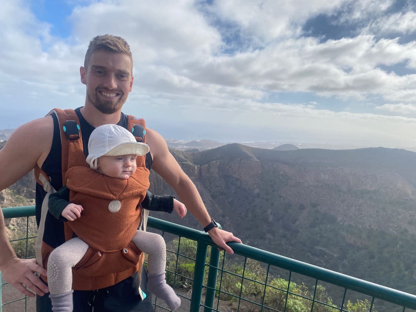
In the middle of the hilly landscape around Santa Brígida on Gran Canaria lies one of the most impressive volcanic formations on the island: the Caldera de Bandama. This crater path offers a scenic walking route with outstanding views and a fascinating history that goes back thousands of years.
We have just completed the route, a 3.5 km walk around the crater, which took about an hour to finish, even with a baby on the front. Here you get our review of the route and an introduction to this spectacular area.
The history behind the Caldera de Bandama
The Caldera de Bandama is the remains of an explosive volcano that was active around 2,000 years ago. The name comes from the Dutch merchant Daniel Van Damme, who tried to grow wine in the fertile crater floor in the 1500s. The crater has a diameter of about 1 kilometre and a depth of around 200 metres, which makes it one of the most striking geological formations in the Canary Islands. Today the area is part of a nature reserve and a popular destination for walkers and nature lovers.
| Fact | Description |
|---|---|
| Length | About 3.5 km around the crater |
| Time | About an hour |
| Difficulty | Easy, with small ascents and descents |
| Starting point | The viewpoint at Pico de Bandama |
| Crater diameter | About 1 kilometre |
| Crater depth | About 200 metres |
The route around the Caldera de Bandama
The walking route around the crater is well maintained and easily accessible, which makes it ideal for both beginners and experienced walkers. We started our trip from the viewpoint at Pico de Bandama, from where you can see the whole crater, the Atlantic Ocean and even Las Palmas on the horizon.
The trip is 3.5 km long and runs through varied terrain with gentle ascents and descents. The path is wide and well defined, so even with a baby in a carrier we felt safe the whole way. Along the way you experience a shifting landscape of dry lava fields, lush slopes and viewpoints where you can really sense the depth of the crater.
What you can expect along the way
- Fantastic views: The path gives panoramic views over the crater and the surrounding landscape. On clear days in particular you can see far out over Gran Canaria’s coastline.
- Rich vegetation: Despite the volcanic terrain, the crater’s slopes are covered with Canary Island pines, cacti and wildflowers.
- Easy access: Although there are some small ascents, the path is generally easy to walk and does not require special hiking gear.
- Geological fascination: The interior of the crater is living proof of the island’s volcanic past, and you can see clear layers of lava and ash.
Tips for the trip
- Bring good hiking socks and sturdy shoes, as there are small stones in places on the path.
- Bring electrolytes or enough water, as there is little shade.
- Set off early in the day to avoid the strong midday sun, especially if you are walking with children.
- If you have time, you can take a detour to the crater floor, where ruins from old farms still stand.
Is the trip worth it?
Yes. The Caldera de Bandama is one of Gran Canaria’s most spectacular short hikes, and it gives a truly unique experience of the island’s volcanic landscape. The route is easy to walk and can be done in an hour, which makes it a perfect stop if you want to combine hiking with other experiences on the island. It also works as a good training route if you are preparing for longer hikes like the Camino or Amarminoen.
If you are planning an active holiday on Gran Canaria, this walking route should be high on your list. The nature, the history and the outstanding views make it an experience you will not soon forget.
The Camino on Gran Canaria
Gran Canaria may not be the first place you associate with the Camino, but the island actually offers several fantastic walking routes that give a similar experience. One of the most popular is the Camino de Santiago de Gran Canaria, which stretches from Maspalomas in the south to Gáldar in the north. The route has been used by pilgrims for centuries and gives a unique chance to experience the island’s varied landscape, from sand dunes and mountain ranges to lush forests and small villages.
The trip is around 66 km long and can be completed in three to four days depending on pace and fitness. Many people choose to take it as a training trip for the more famous Camino de Santiago in Spain, as Gran Canaria’s mountainous terrain provides a good physical challenge.
Other walking routes on Gran Canaria
Besides the Camino route, there are a number of fantastic walking routes on Gran Canaria that let adventurous walkers explore the island’s spectacular landscape. Whether you prefer coastal paths, mountain hiking or more wooded areas, there is something for every taste.
If you want to dive into more exciting routes, you can read more here: Hiking routes on Gran Canaria.
There is also the option to play golf on the route, if that happens to interest you.
Frequently asked questions
How long is the route around the Caldera de Bandama?
Is the hike in the Caldera de Bandama hard?
Where do you start the hike?
How big is the Caldera de Bandama?
What should you remember to bring?
Is the trip suitable for children?
Camino King
The walker who never stopped
Michael walked his first Camino in 2016 and has kept going ever since. He writes about the routes, the gear and everything that makes a long walking day good. If it is here, it has been walked, worn or weighed.
Read next
Denmark
The Five Best Hiking Routes on Bornholm
From the Helligdomsklipperne cliffs to Dueodde: here are the five best hiking routes on Bornholm with distances, difficulty and practical info for your trip.
World
The 10 Best Hiking Trails on Gran Canaria: A Guide to the Island's Most Beautiful Paths
Gran Canaria is a hiker's paradise. Discover the 10 best trails on the island, from Roque Nublo to the Maspalomas dunes, tested on foot by a Camino walker.
Denmark
Farum Lake Loop: the Best 10 km Route on Zealand?
It is about 10 km around Farum Lake. See the map, facts, parking and sights like Gretesholm on one of north Zealand's best walking routes.